

Filed As:
Lecythidaceae
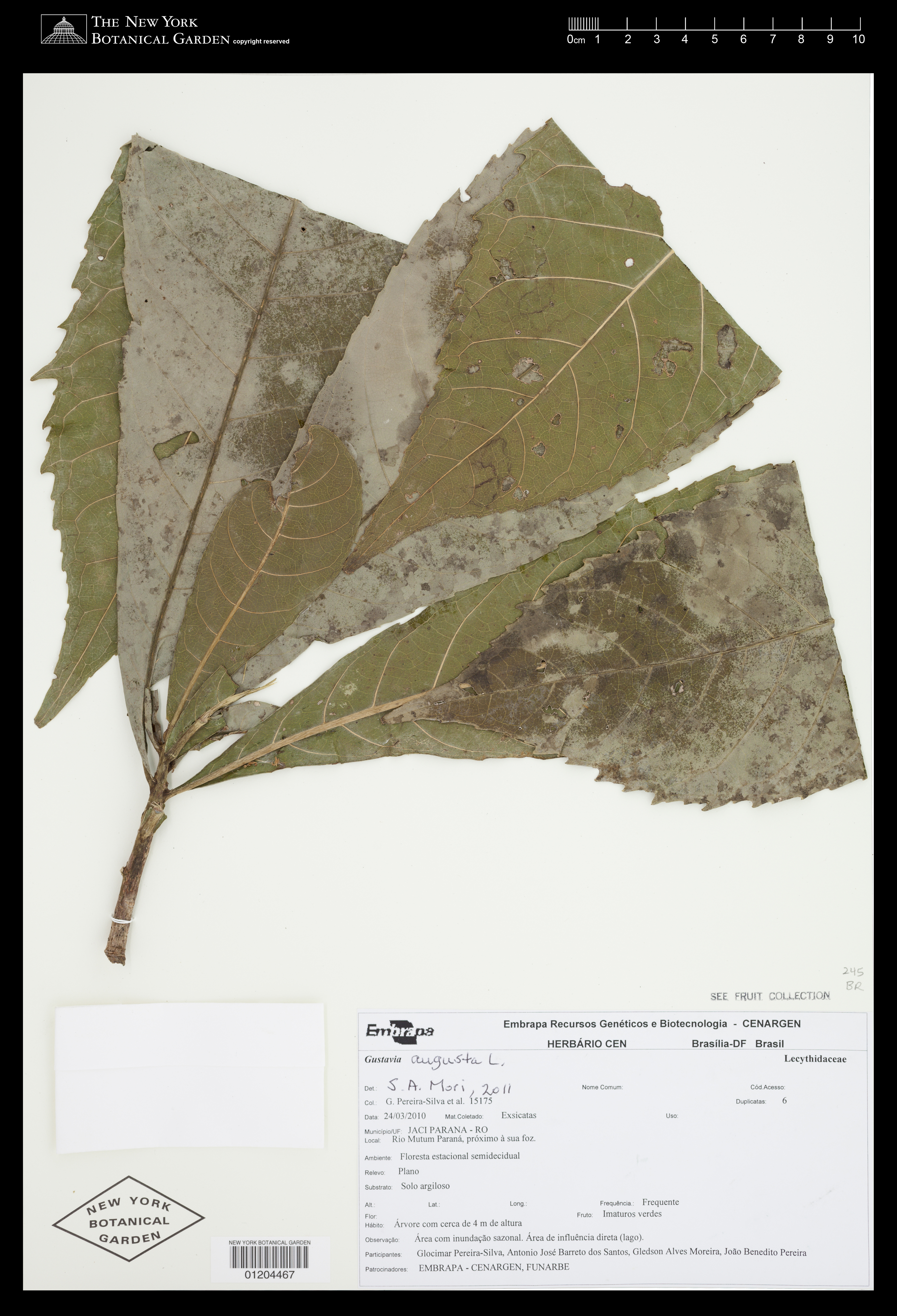
Gustavia augusta L.
Lecythidaceae
Gustavia augusta L.
Location:
Brazil. Rondônia. Jaci Parana. Rio Mutum Paraná, próximo à sua foz.
Brazil. Rondônia. Jaci Parana. Rio Mutum Paraná, próximo à sua foz.
Collector(s):
G. Pereira-Silva 15175 with A. José Barreto dos Santos, G. Alves Moreira, J. Benedito Pereira, 24 Mar 2010
G. Pereira-Silva 15175 with A. José Barreto dos Santos, G. Alves Moreira, J. Benedito Pereira, 24 Mar 2010
Description:
Árvore com 4 m de altura. Fruto: Imaturos verdes. Observação: Área com inundação sazonal. Área de influência directa (lago). Phenology of specimen: Fruit.
Árvore com 4 m de altura. Fruto: Imaturos verdes. Observação: Área com inundação sazonal. Área de influência directa (lago). Phenology of specimen: Fruit.
Habitat:
Floresta estacional semidecidual. Frequent. Solo argiloso. Relevo: Plano.
Floresta estacional semidecidual. Frequent. Solo argiloso. Relevo: Plano.
Identifiers:
NY Barcode: 01204467
GUID: aa3ee74f-45a6-425a-b119-c44d2779c862
NY Barcode: 01204467
GUID: aa3ee74f-45a6-425a-b119-c44d2779c862
Related Objects:
Specimen - 01204468, G. Pereira-Silva 15175, Gustavia augusta L., Lecythidaceae (245.0), Magnoliophyta; South America, Brazil, Rondônia
Specimen - 01204468, G. Pereira-Silva 15175, Gustavia augusta L., Lecythidaceae (245.0), Magnoliophyta; South America, Brazil, Rondônia
Map:
Georeferencing Method: Georeferencing Quick Reference Guide, Version 2012 (Georeferenced to the approximate geographic center of the mouth of Rio Mutumparaná in Rondônia, Brazil. Using Google Maps - Satellite View, located Rio Mutumparaná, a tributary of Rio Cutia. Used Canadensys Lat/Long Crosshairs to find the coordinates of the approximate geographic center of the mouth of the river, on the adjacent shore (collection assumed to be terrestrial). Used the Distance Measurement Tool (Google Maps) to find the linear extent by measuring from the selected coordinates to the farthest extent of the mouth of the river (confluence of Rio Mutumparaná and Rio Cutia). Input coordinates, linear extent (72.4323 m), and measurement error (0.5 m) into the MaNIS Georeferencing Calculator to find the uncertainty radius (according to Georeferencing Quick Reference Guide, Named Place: Mouth or headwaters of a river, confluence of waterways, trailhead).)
Coordinate Uncertainty(m): 74.501
Geodetic Datum: WGS84
Coordinates: (-9.6779, -64.9798)
Georeferencing Method: Georeferencing Quick Reference Guide, Version 2012 (Georeferenced to the approximate geographic center of the mouth of Rio Mutumparaná in Rondônia, Brazil. Using Google Maps - Satellite View, located Rio Mutumparaná, a tributary of Rio Cutia. Used Canadensys Lat/Long Crosshairs to find the coordinates of the approximate geographic center of the mouth of the river, on the adjacent shore (collection assumed to be terrestrial). Used the Distance Measurement Tool (Google Maps) to find the linear extent by measuring from the selected coordinates to the farthest extent of the mouth of the river (confluence of Rio Mutumparaná and Rio Cutia). Input coordinates, linear extent (72.4323 m), and measurement error (0.5 m) into the MaNIS Georeferencing Calculator to find the uncertainty radius (according to Georeferencing Quick Reference Guide, Named Place: Mouth or headwaters of a river, confluence of waterways, trailhead).)
Coordinate Uncertainty(m): 74.501
Geodetic Datum: WGS84
Coordinates: (-9.6779, -64.9798)