Sites Module: Difference between revisions
No edit summary |
No edit summary |
||
| Line 1: | Line 1: | ||
<parsererror style="display: block; white-space: pre; border: 2px solid #c77; padding: 0 1em 0 1em; margin: 1em; background-color: #fdd; color: black"> | |||
=== This page contains the following errors: === | |||
<div style="font-family:monospace;font-size:12px">error on line 1 at column 2097: attributes construct error </div> | |||
=== Below is a rendering of the page up to the first error. === | |||
</parsererror> | |||
=== <span style="font-family:arial,helvetica,sans-serif;">Locality Tab</span> === | === <span style="font-family:arial,helvetica,sans-serif;">Locality Tab</span> === | ||
| Line 8: | Line 13: | ||
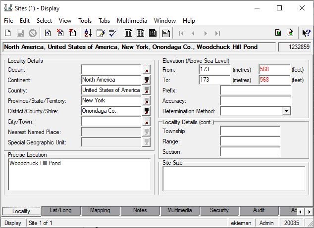
[[File:Sites locality tab.jpg|left|Example of a completed Locality tab of a Sites record.]] | [[File:Sites locality tab.jpg|left|Example of a completed Locality tab of a Sites record.]] | ||
=== <span style="font-family:arial,helvetica,sans-serif;"><span style="color: rgb(51, 51, 51);">Mapping Tab</span></span> === | |||
Revision as of 16:09, 21 April 2021
<parsererror style="display: block; white-space: pre; border: 2px solid #c77; padding: 0 1em 0 1em; margin: 1em; background-color: #fdd; color: black">
This page contains the following errors:
Below is a rendering of the page up to the first error.
</parsererror>
Locality Tab
Enter all available geographic information from the specimen label into the appropriate field. Continent, Country, and Province/State/Territory lookup lists are up-to-date and have been locked, meaning that the values in these fields cannot be added to or edited. If a value from a label is not displaying in the drop-down list of one of the aforementioned fields, this indicates that the information on the label is outdated, incorrect, or that you are trying to place information into the incorrect field. The information that does not fit into one of these categories still needs to be captured, but should be alternatively placed in the Precise Location field. If there is no specific locality description to be placed in the Precise Location field, please leave the field blank and do NOT record “[no precise location]" or a variation of that phrase in brackets; standard practice is to keep the field blank. If elevation is provided on the label, enter that information in the Elevation (Above Sea Level) field(s) (if provided in a range, the lower elevation value should be placed in the “From:” field, and the higher elevation value in the “To:” field). Sometimes location information is provided in Township, Range, and Section (TRS) format; place that information in the Locality Details section (below Elevation), ensuring that letters "T", "R", and "S" are included as the prefix before appropriate value/direction (i.e. T10S, R23E, S12).
