
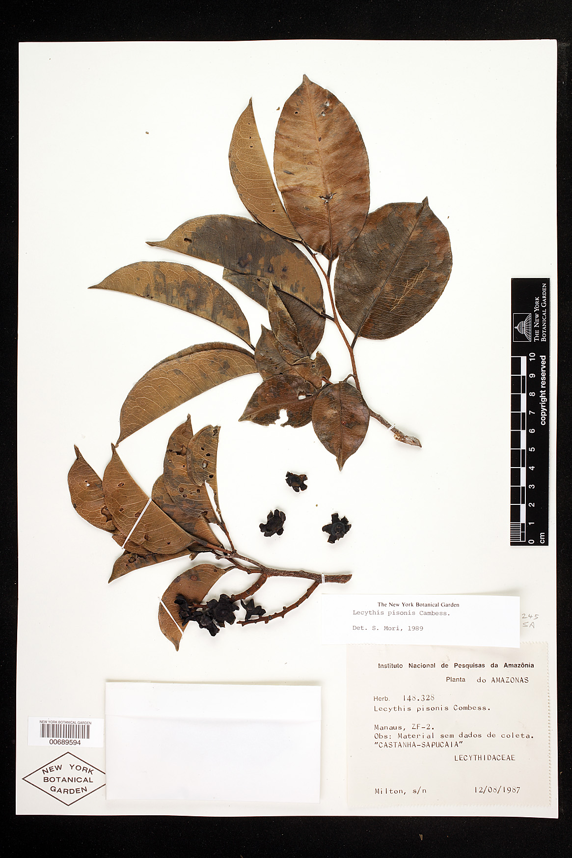


Filed As:
Lecythidaceae
Lecythis pisonis Cambess.
Lecythidaceae
Lecythis pisonis Cambess.
Common Names:
castanha-sapucaia
castanha-sapucaia
Location:
Brazil. Amazonas. Manaus Mun. Manaus. ZF-2.
Brazil. Amazonas. Manaus Mun. Manaus. ZF-2.
Description:
Phenology of specimen: Flower.
Phenology of specimen: Flower.
Other:
Collection Notes: "Material sem dados de coleta."
Collection Notes: "Material sem dados de coleta."
Identifiers:
NY Barcode: 00689594
GUID: 202ce205-0241-4018-b54c-28bcf051feee
NY Barcode: 00689594
GUID: 202ce205-0241-4018-b54c-28bcf051feee
Map:
Georeferencing Method: Georeferencing Quick Reference Guide, Version 2012 (Georeferenced to the geographic center of road ZF-2. Referred to Suframa website (http://www.suframa.gov.br/mapa4.swf), which provided a map showing location of ZF-2. Road ZF-2 meets BR-174 at approximately 50 km. from Manaus toward Caracarai. Used measurement tool to measure a straight line starting at the junction with BR-174 to the end of ZF-2. Halved this distance to approximate the geographic midpoint of the road. Used Canadensys Lat/Long Crosshairs to find the coordinates. Input coordinates, linear extent (distance from the midpoint along the road to the farthest point on the feature that is within the administrative boundaries specified in the locality description - 11487.0 m.), and measurement error (.1 m.) into the MaNIS Georeferencing Calculator to find the uncertainty radius.)
Coordinate Uncertainty(m): 11488.7
Geodetic Datum: WGS84
Coordinates: (-2.59895, -60.122)
Georeferencing Method: Georeferencing Quick Reference Guide, Version 2012 (Georeferenced to the geographic center of road ZF-2. Referred to Suframa website (http://www.suframa.gov.br/mapa4.swf), which provided a map showing location of ZF-2. Road ZF-2 meets BR-174 at approximately 50 km. from Manaus toward Caracarai. Used measurement tool to measure a straight line starting at the junction with BR-174 to the end of ZF-2. Halved this distance to approximate the geographic midpoint of the road. Used Canadensys Lat/Long Crosshairs to find the coordinates. Input coordinates, linear extent (distance from the midpoint along the road to the farthest point on the feature that is within the administrative boundaries specified in the locality description - 11487.0 m.), and measurement error (.1 m.) into the MaNIS Georeferencing Calculator to find the uncertainty radius.)
Coordinate Uncertainty(m): 11488.7
Geodetic Datum: WGS84
Coordinates: (-2.59895, -60.122)