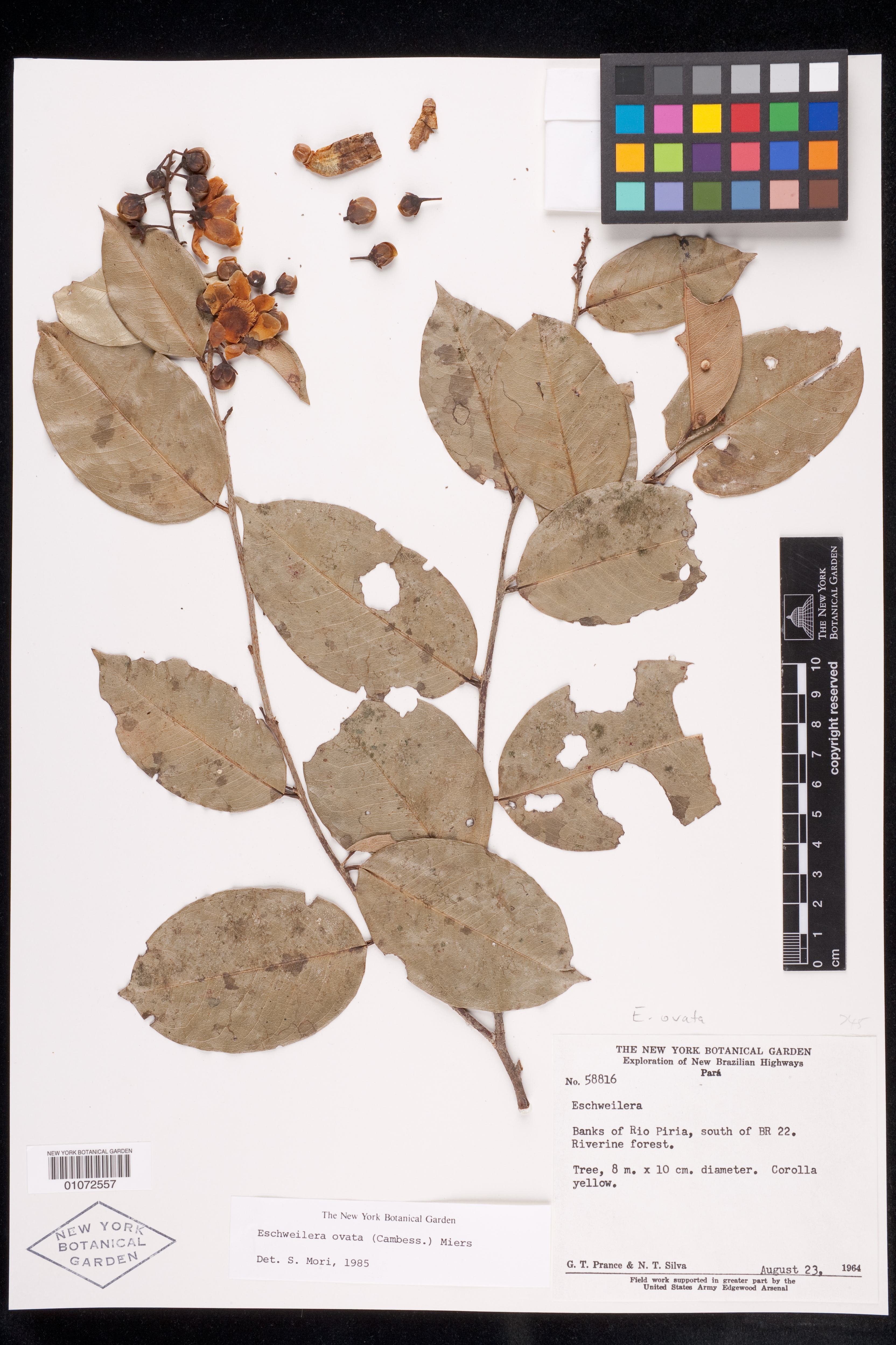
Eschweilera ovata (Cambess.) Mart. ex Miers
Description: Herbarium sheet of Eschweilera sp based on Prance & N. T. Silva 58816 from Pará, Brazil.
Rights: Rights reside with creator, otherwise property of NYBG.
-
Filed As
Lecythidaceae
Eschweilera ovata (Cambess.) Mart. ex Miers -
Collector(s)
G. T. Prance 58816 with N. T. Silva, 23 Aug 1964
-
Location
Brazil. Pará. Banks of Rio Piria, south of BR 22.
-
Identifiers
NY Barcode: 01072557
Occurrence ID: 1395a04d-96e4-4131-9111-90ea91b1b417
-
Feedback
-
Kingdom
Plantae
-
Division
Magnoliophyta
-
Order
Ericales
-
Family
Lecythidaceae
-
All Determinations
Eschweilera ovata (Cambess.) Mart. ex Miers det S. A. Mori, 20 Feb 2014
Eschweilera Mart. ex DC. det S. A. Mori, 1985
-
Region
South America
-
Country
Brazil
-
State/Province
Pará
-
Locality
Banks of Rio Piria, south of BR 22
-
Coordinates
-1.77379, -46.6401
-
Coordinate Uncertainty (m)
6921.57
-
Georeferencing Method
Georeferencing Quick Reference Guide, Version 2012. Difficult to determine the exact location along the banks of Rio Piriá to georeference to (locality description vague). Also note that road BR-22 is synonymous with BR-316, in accordance with Google Maps - Directions. Determined the locality along the river to be located between the intersection with road BR-316 and with the following road along the stretch of the river (southern direction), PA-108 (under the assumption that if collection was made closer to PA-108, it would have been noted as such). Georeferenced to the approximate geographic midpoint of Rio Piriá south of the intersection with road BR-316 and with road PA-108, in Mun. Viseu, Pará. Used Google Maps - Earth View to locate Rio Piriá nearby road BR-316. Used the Google Maps - Measure Distance Tool to measure a straight line between the intersection of Rio Piriá and BR-316 and the intersection of Rio Piriá and PA-108 and then halved this distance to find the midpoint of the line. Chose a point along the shore of Rio Piriá nearest to the midpoint of the line; used the Google Maps - What's Here Tool to find the coordinates of the approximate midpoint of this section of river. Used the Google Maps - Measure Distance Tool again to find the linear extent by measuring from the selected coordinates to the farthest extent of this segment of river. Input coordinates, linear extent (6910.0 m), and measurement error (10 m) into the MaNIS Georeferencing Calculator to find the uncertainty radius.
-
Geodetic Datum
WGS84
-
Distribution


Please submit your comments about the specimen:
Eschweilera ovata (Cambess.) Mart. ex Miers