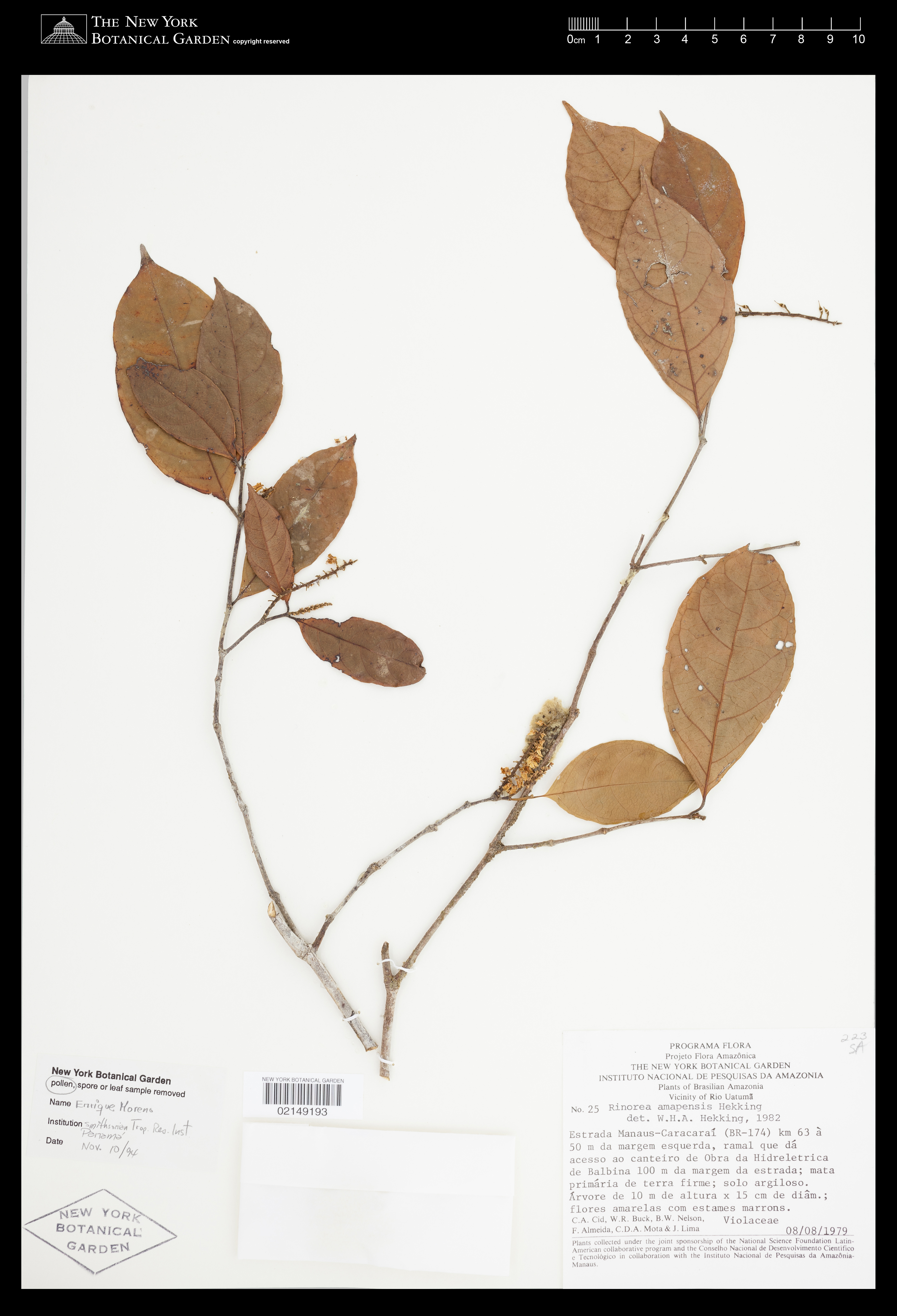


Filed As:
Violaceae
Rinorea amapensis Hekking
Violaceae
Rinorea amapensis Hekking
Location:
Brazil. Amazonas. Estrada Manaus-Caracaraí (BR 174), Km 63 a 50m da margem esquerda, ramal que dá acesso ao Canteiro de Obras da Hidrelétrica de Balbina 100m da margem da estrada.
Brazil. Amazonas. Estrada Manaus-Caracaraí (BR 174), Km 63 a 50m da margem esquerda, ramal que dá acesso ao Canteiro de Obras da Hidrelétrica de Balbina 100m da margem da estrada.
Collector(s):
C. A. Cid Ferreira 25 with W.R. Buck, B.W. Nelson, F. Almeida, C.D.A. Mota & J. Lima, 08 Aug 1979
C. A. Cid Ferreira 25 with W.R. Buck, B.W. Nelson, F. Almeida, C.D.A. Mota & J. Lima, 08 Aug 1979
Identifiers:
NY Barcode: 2149193
GUID: d0b7da16-f2b5-4b6d-8d56-b709ff857066
NY Barcode: 2149193
GUID: d0b7da16-f2b5-4b6d-8d56-b709ff857066
Map:
Georeferencing Method: Georeferencing Quick Reference Guide, Version 2012 (Using Google Maps, located the road connecting Manaus to Caracaraí, BR-174. Beginning at the start of this road in Manaus, used the measurement tool to measure approximately 63 km. (63.0000 km.) along the road toward Caracaraí. Used Canadensys Lat/Long Crosshairs to find the coordinates. Used measurement tool again (Google Maps) to measure the linear extent of Manaus. Input coordinates, linear extent (14317.95 m.), offset distance (50 m.), measurement error (.01 m.), and distance precision (1 m.) into the MaNIS Georeferncing Calculator to calculate the uncertainty radius (according to Georeferencing Quick Reference Guide, Offset: Offset only, no direction).)
Coordinate Uncertainty(m): 14370
Geodetic Datum: WGS84
Coordinates: (-2.42815, -60.0294)
Georeferencing Method: Georeferencing Quick Reference Guide, Version 2012 (Using Google Maps, located the road connecting Manaus to Caracaraí, BR-174. Beginning at the start of this road in Manaus, used the measurement tool to measure approximately 63 km. (63.0000 km.) along the road toward Caracaraí. Used Canadensys Lat/Long Crosshairs to find the coordinates. Used measurement tool again (Google Maps) to measure the linear extent of Manaus. Input coordinates, linear extent (14317.95 m.), offset distance (50 m.), measurement error (.01 m.), and distance precision (1 m.) into the MaNIS Georeferncing Calculator to calculate the uncertainty radius (according to Georeferencing Quick Reference Guide, Offset: Offset only, no direction).)
Coordinate Uncertainty(m): 14370
Geodetic Datum: WGS84
Coordinates: (-2.42815, -60.0294)