Tapajós National Forest
Tapajós National Forest (TNF) was created in 1974 and is an area of 5,600 square kilometers south of the city of Santarém, on the east bank of the Tapajós River. The eastern border of TNF is formed by the Santarém-Cuiaba road (BR-163), from which several access roads depart. Part of TNF is maintained in primary condition, while the remaining area is maintained under various categories of management, primarily for timber and non-timber resource extraction. The area is managed by the Chico Mendes Institute (ICMBio) in conjunction with the Brazilian Ministry of the Environment (IBAMA). Several villages along the Tapajós River are contained within its borders and are surrounded by special community administered zones. While ecotourism has been little developed, the close proximity of TNF to the city of Santarém and other tourist attractions such as the beach at Alter do Chão and Henry Ford’s historical rubber plantations at Fordlandia and Belterra, as well as relatively abundant wildlife, suggest that the area holds substantial potential in this area. TNF has been described as a model area for sustainable forestry but is threatened by expansion of the aforementioned settlements and agricultural encroachment. The Large-Scale Biosphere-Atmosphere Experiment in Amazonia (LBA) was an international research initiative that operated in TNF from 1995 to 2005, with the aim of quantifying the net ecosystem exchange of carbon dioxide and water in a primary forest. The project left behind research infrastructure and long-term monitoring plots.
Amazonia National Park
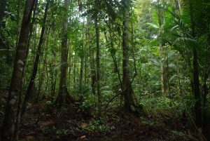
Amazonia National Park (ANP) was created in 1974 and is the oldest National Park in the Brazilian Amazon. The park encompasses 10,800 square kilometers south and west of the city of Itaituba on the west bank of the Tapajós River (Fig. 1). It spans portions of the Tapajós Basin, as well as the smaller drainages of the Andirá, Maraú, and Mamuru Rivers, which flow to the northwest towards the Amazon River. The park is crossed by the Transamazonian road (BR-360), which provides access, as does the 30-km Capelinha Trail that traverses a portion of the park’s interior and serves as a local attraction for ecotourism. ANP is managed under strict preservation by ICMBio, which maintains a field station within the park’s boundaries. ANP faces a range of threats, including illegal logging and mining, encroachment from expanding settlements near the city of Itaituba, and a planned hydroelectric dam on the Tapajós River that will create one of the largest reservoirs in Brazil, flooding critical habitats near the river.