Geographic Information Systems (GIS) are specialized software for the storage, sharing, visualization, and analysis of geographically-referenced data. The datasets of a GIS, called layers, are representations of real-world phenomena, such as points representing plant collections. GIS allows for the exploration of spatial relationships through these data layers, which often reveal biogeographical patterns which can only be discovered once spatially-aligned and plotted collaboratively on a map.
Activities in the GIS Lab are centered around the specimens of the William and Lynda Steere Herbarium (virtually available on the C.V. Starr Virtual Herbarium website). GIS projects are specialist-driven and/or grant-funded project based.
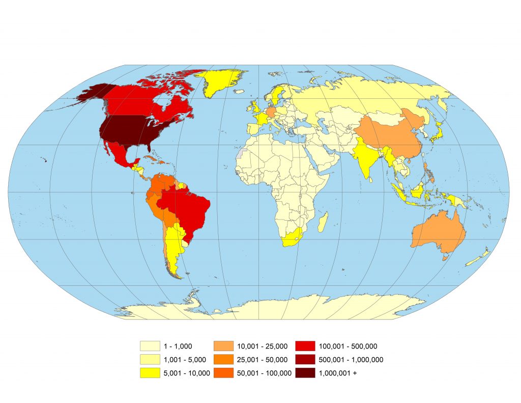
The William & Lynda Steere Herbarium’s collection density per country
Georeferencing
Georeferencing is the process of determining geographic coordinates (latitude and longitude) from a written locality description on a specimen label. Through this process we also calculate an error radius, which is designed to incorporate all sources of uncertainty to accurately describe the area in which the collection may have occurred. Georeferencing involves using a variety of tools, including online mapping applications as well as gazetteers, collector’s field notebooks, and paper maps. We follow georeferencing best practices set out by the natural history community; please see Georeferencing Best Practices and the Georeferencing Quick Reference Guide for more information.
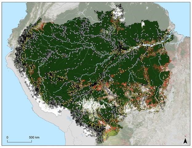
Map highlighting botanical collections which are in fire-disturbed regions of the Amazon
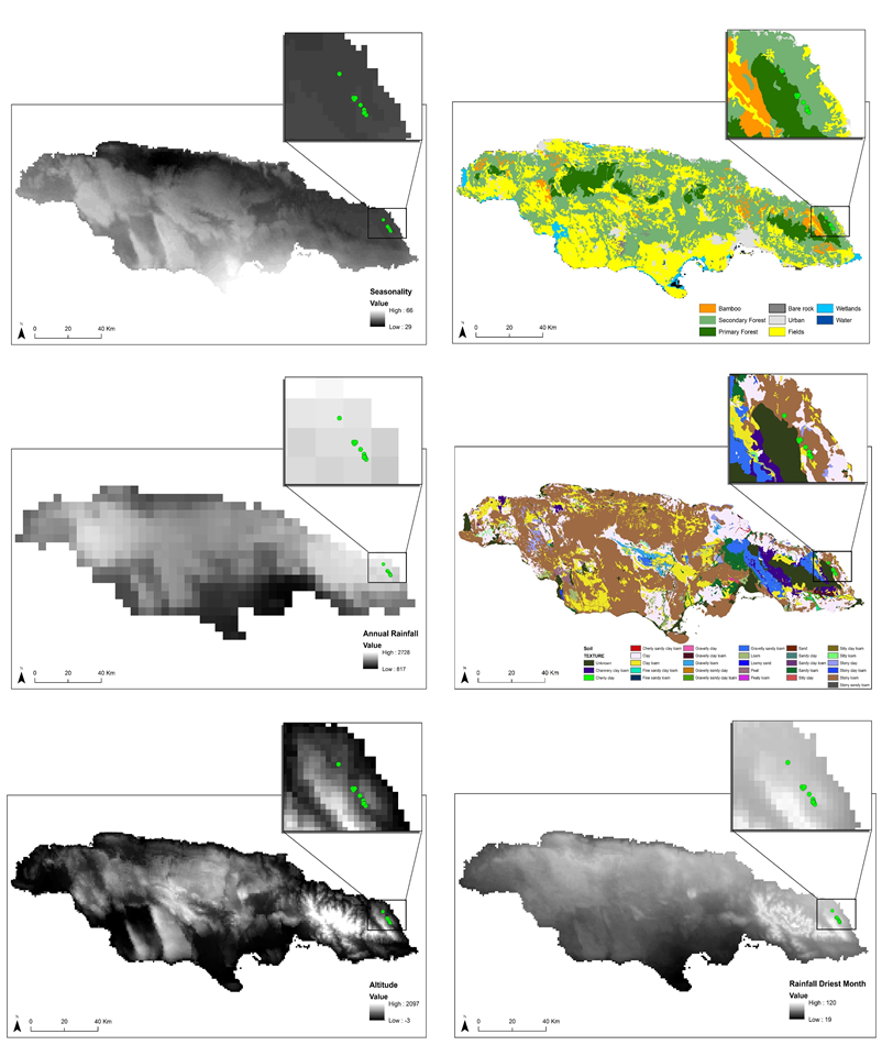
Environmental dataset layers and occurrence geocoordinate data (green dots) for a plant species endemic to Jamaica.
MAPPING AND MODELLING
Distribution and range maps aid in understanding a species’ approximate geographic extent, and are a powerful tool in observing change over time, especially for invasive species or plants with threatened habitats. These types of maps are also critical in learning about and describing newly discovered species.
Species distribution models combine environmental factors (land-use, soil, climate data, etc.) and botanical collection data points to discover which factors correlate most favorably to a species survival and where shifts may occur due to changes in our climate. GIS modeling of plant species can provide compelling arguments for policy decisions that involve a geographic component, such as conservation of crucial habitats or guidance in the protection of a species at risk throughout some or all of its natural range.